


")
UAV/Drone Services
Drones
UAVs/UASs , more commonly referred to as drones, are an essential component of Rogue Visual Design’s toolbox. Drones can easily inspect inaccessible locations and rapidly gather datasets for large regions. While they are invaluable tools on their own, blending the entire repertoire of our reality capture technologies enables us to tackle projects that would be otherwise impossible to complete.
These flying data collectors augment our terrestrial LiDAR capabilities nationwide. Our team combines highly accurate point cloud data from LiDAR/laser scanners with UAV/UAS photogrammetry. This combo creates dimensionally accurate aerial photographs or point clouds.
What is a Drone?
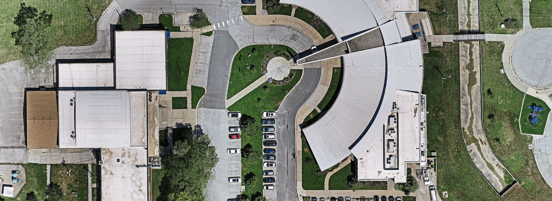
A drone is an Unmanned Aerial Vehicle/System (UAV/UAS). At Rogue Visual Design, these high-resolution, flying cameras complement our LiDAR 3D modeling capabilities. Drones offer two additional state-of-the-art capabilities: photogrammetry and orthomosaics. Photogrammetry stitches thousands of slightly differing photos together to assist in triangulating points in 3D space. Orthomosaics stitch photos together to produce 2D images – think Google Earth, but without perspective distortion. It’s great for site plans.
How can Drones benefit your company and projects?
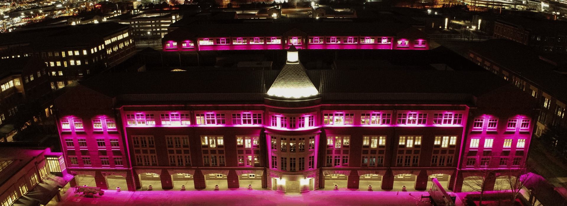
Using a drone for site documentation has many benefits over traditional methods, which often require assembling ladders and scaffolding. Taking pictures of roofs, towers, utilities, and equipment with a drone is faster and safer. A drone can fly several million square feet in a matter of minutes! Using our drone, we documented nine apartment complexes in just over half an hour.
The results of documenting a site by drone are more accurate than traditional methods. Our images are realistically scaled with a choice of resolution depending on altitude. Using drones, our expert pilots can develop a precise backdrop for your site plan and show the real-world context around your worksite.
While drones are an invaluable tool on their own, blending the entire repertoire of our reality capture technologies enables Rogue to tackle projects that would be otherwise impossible to complete. Our team combines highly accurate point cloud data from LiDAR/laser scanners with UAV/UAS techniques to create dimensionally accurate replications. These flying data collectors enhance our terrestrial LiDAR and photo documentation capabilities nationwide. Why draw when you can show?
Safety
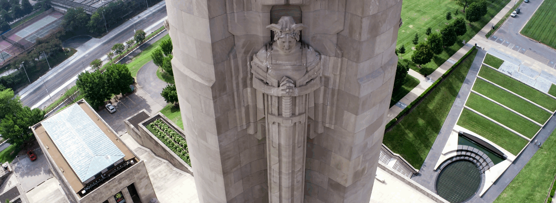
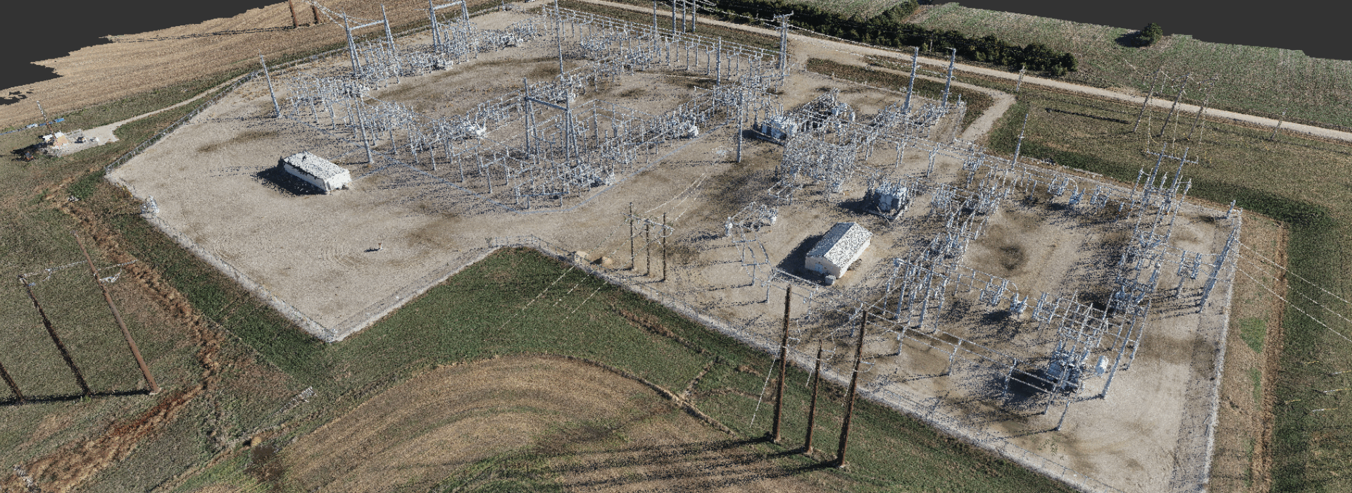
Rogue Visual Design’s UAS services enhance site safety. Since drones operate from the air, Rogue’s pilots can remotely gather data without needing personnel on ladders, scaffolding, or lifts. We can document a substation from 200 feet away. We can inspect a 130 spire or a duct suspended 400′ in the air while our crew is safely on the ground. We can fly into the interior of an abandoned ICBM launch tube with 100′ of water at the bottom. Furthermore, our pilots are FAA Part 107 certified and adhere to the Federal Aviation Administration’s rules and regulations.
Applications for Drone Services
Infrastructure
-
- Roads
- Bridges
- Railroads
Site Mapping/Inspections
-
- Building Inspections
- Tower Inspections
- Utility Mapping/Inspections
- Roof Inspections
Volume Measurements
Aerial Photography
Orthomosaic Maps
Topographic Data Collection
-
- Contour / Topography Maps
- TIN Models
GIS Data Collection
-
- Above ground
- Exposed Underground Utilities
Custom Deliverables for Drone Services
- Point Clouds
- 3D CAD and BIM Models
- 2D Orthomosaic photos
- 2D CAD Drawings
- 3D Contours
- TIN Models
- Volume Measurements