Collage 1: The Notre-Dame fire of April 2019. Full image credits are available at the end of the blog.
Like so many others, we watched in dismay and heartbreak as the fire ravaged Notre-Dame. The world famous medieval Catholic cathedral in Paris, France, is a cultural treasure; architectural, artistic, historical, religious, engineering, etc. A truly marvelous structure. The majestic Notre Dame Cathedral began as a ‘humble’ temple. Originally constructed in the 4th Century and dedicated to St. Stephen as the “Cathedral of Saint Ettienne.” In 1163, Bishop Maurice de Sully began what we now know as the world-famous structure. Over the last 850 years, Notre Dame has undergone several renovations and additions. Flying Buttresses completed in 1200. Twin Towers added 1210-1220. The Rose window was added in 1270 and rebuilt twice. Once in 1725 and again in 1854. In 1699 King Louis XIV began a major redecoration. Many other additions were made as ownership changed from the Roman Catholic Church to the country of France, due to conquests of Napoleon.

Collage 2: Restoration efforts to rebuild Notre-Dame Cathedral. Full image credits are available at the end of the blog.
On 15 April 2019, a suspected electrical fire destroyed a large part of the roof and the flèche. That tragic fire and subsequent destruction should raise awareness of the importance of protecting all the world’s cultural heritage. After the fire, French president Emmanuel Macron pledged to restore the damage by 2025. This is an ambitious goal and is on schedule! Fortunately, the cathedral is one of the most documented structures in the world including numerous laser scans completed since the renovations began. This information is invaluable to the architects, engineers, and craftsman working to restore Notre-Dame.

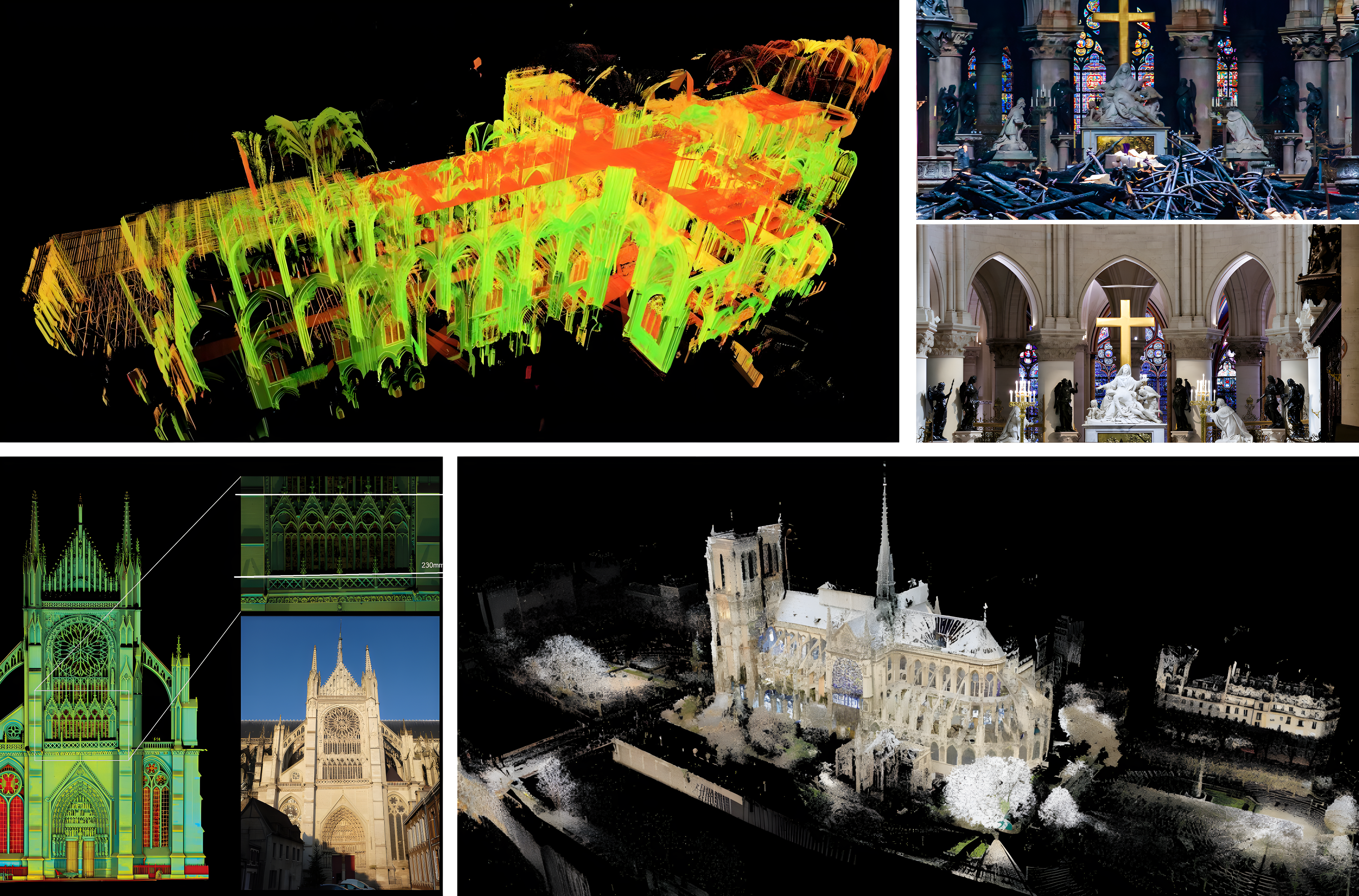
Collage 3: The role of LIDAR in preserving and restoring Notre-Dame Cathedral. Full image credits are available at the end of the blog.
Now imagine… What if LiDAR could have been used from the original start date in the 12th century? Do construction documents for a structure like this even exist? What if all the modifications, changes, fixes, etc. could have undertaken with a point cloud for assistance? How much less would this cost France? How much quicker could the project(s) have been completed? These are rhetorical questions with no solid answers, but anyone who’s done a remodel, addition, cleanup, or any other similar architectural structure construction project knows the answer. Incalculable. And this is the world-famous Notre-Dame Cathedral.
LiDAR is being used during this restoration. The data being gathered will make any type of future project much more efficient.
For a deeper dive into the groundbreaking role of LIDAR in the restoration of Notre-Dame Cathedral, watch this fascinating video. It provides an in-depth look at how this cutting-edge technology captured the cathedral’s intricate details and supported its reconstruction efforts.
Click play to explore the advanced capabilities of LIDAR and its impact on preserving architectural history.
Image Credits
Collage 1: Fire
This collage features images capturing the devastation of the Notre-Dame fire in April 2019. Credits:
- Ian Langsdon/EPA (Image1)
- Erieta Attali (Images 2, 5, 7, 8, 12, 14)
- Quentin Mahéas / La Clef Production (Image 3)
- Philippe Lopez / AFP/Getty Images (Image 4)
- GodefroyParis, CC BY-SA 4.0 (Image 6)
- Thibault Camus/AP Photo (Image 9)
- LEVRIER Guillaume, CC BY-SA 4.0 (Image 10)
- Cilcée, CC BY-SA 4.0 (Image 11)
- Francois Guillot / AFP/Getty Images (Image 13)
Collage 2: Restoration
This collage highlights the remarkable restoration efforts at Notre-Dame Cathedral following the 2019 fire. Credits:
- Christophe Ena / Pool / AFP / Getty Images (Image 1)
- Tom1911, CC BY-SA 4.0 (Image 2)
- Stephane Mahe, Reuters (Image 3)
- Patrick Zachmann/Magnum (Image 4)
- Travel and Tour World (Image 5)
- Damien Meyer, AFP via Getty Images (Image 6)
- Michel Euler / Associated Press (Image 7)
Collage 3: LIDAR
This collage showcases the use of LIDAR technology in preserving and restoring Notre-Dame Cathedral. Credits:
- Andrew Tallon / National Geographic (Image 1)
- Christophe Petit Tesson and Stephane de Sakutin, Pool via AP (Image 2)
- Images of Notre Dame Cathedral in Amiens, highlighting the south facade’s tilt issue (Image 3)
- Andrew Tallon / Vassar College (Image 4)